Navigation
Install the app
How to install the app on iOS
Follow along with the video below to see how to install our site as a web app on your home screen.

Note: This feature currently requires accessing the site using the built-in Safari browser.
More options
You are using an out of date browser. It may not display this or other websites correctly.
You should upgrade or use an alternative browser.
You should upgrade or use an alternative browser.
Video: Stealth Sunfish
- Thread starter andyatos
- Start date
Nice; isn't it (a bit) scary to sail into the fog? No (crazy) motorboaters out there?
L&VW
Well-Known Member
Say "Stealth Sunfish" three times fast!
andyatos
Well-Known Member
Fortunately, it's extremely rare to encounter motor boats on the section of the Russian River that I sail on. That's from the mouth to Duncans Mills. In fact, any motor boats operating on that section are restricted by law to speeds of 5 mph or less. Because of this speed restriction, it's a non motorized boating area for all intents and purposes. Pretty cool actually.Nice; isn't it (a bit) scary to sail into the fog? No (crazy) motorboaters out there?
There has been one group of people, however, who I have seen in 15 to 20 foot long power boats who appear to have no regard for the excess noise and speed laws plainly stated on the books. I'll just call them "researchers" and you can figure out the rest. One boat was a 17 foot Whaler with 2 occupants. I encountered them 5 miles up the river.
When I asked them what they were doing, they said they were "taking water quality samples". Ok, fair enough. But when they started up their outboard I couldn't believe it. It was the loudest outboard motor I've ever heard. And it was belching a ton of smoke. They waved goodbye and took off at full speed. Oh, the irony. Ha!
Another group of "researchers" I encountered more recently launching from the Jenner boat ramp. They explained that they were going up river to check salmon fry traps. Hey, that's cool. I think though that the young women may have been college interns. Because this group required 3 motorboats for their outing! One by one they hit the gas and flew out of sight. Sigh.
So, I guess in answer to your question W.D., I would have to say yes... there ARE crazy motor boaters out there on the Russian River!

Cheers,
- Andy
Last edited:
andyatos
Well-Known Member
Pea soup fog, yes. The fog on this trip, not so much.isn't it (a bit) scary to sail into the fog?

norcalsail
Well-Known Member
Great video Andy...as usual. The river seemed to be running pretty well. Did it bust through again? The mouth was closed for awhile, recently.
andyatos
Well-Known Member
See the attached screen shot below of the Cliff Swallow Bridge gauge for the last 30 days. This latest video "Fog" footage was shot on October 15th. The river had filled up to 7.74 feet but was starting to drop again. This wasn't tidal variation. Something (swell, River Stewards testing partial openings, etc.) had opened up the mouth again just a bit.The river seemed to be running pretty well. Did it bust through again? The mouth was closed for awhile, recently.
Then 2 days later on October 17th it closed up again and stayed closed. When it passed 8 feet I decided I'd go again because, as you well know, when the river is practically bursting its banks, the sailing is fantastic because you can sail bank to bank and not worry about hitting any of the obstacles that are there when the river is lower. Unfortunately, I wasn't able to take advantage of these totally full river conditions because I got sick.
The river peaked on October 26th at 11:15 am at a whopping 11.48 feet. They must have opened the mouth with the usual excavator because the water dropped really fast after that. The full span of high and low tides returned the next morning.
It's too bad we both missed this high water window. It was the highest one this year.
Cheers,
- Andy
Interesting info regarding the flow; thanks!
Any idea about the origin of the name Russian River?
Any idea about the origin of the name Russian River?
andyatos
Well-Known Member
Yes. Why is it called the Russian River?Interesting info regarding the flow; thanks!
Any idea about the origin of the name Russian River?
- Andy Sonfishsky
norcalsail
Well-Known Member
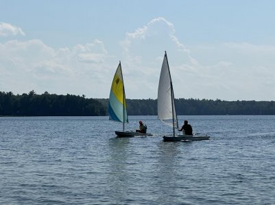
Hey Andy Sonfishsky, thanks for the history and a true, morning LOL! I have been sick for the last week, too. I forgot if we discussed this, but do you also have a new Intensity practice race sail? It looks like it in your photos and I seem to recall that you did (maybe). Mine in Wisconsin gave me an edge over Rick last summer, at least it seemed that way. And my new one here has never been tested. Not quite as beautiful as the one here in the photo, but maybe better performance. I can't believe how far you made it up the river past the Duncan's Mill bridge!
Attachments
andyatos
Well-Known Member
Indeed I do! I love it. And with a cunningham, outhaul and vang tensioning it I am able to sail comfortably in pretty stiff winds. With the exception of when we had to get a tow from the Coast Guard of course.do you also have a new Intensity practice race sail?
")
Ya, it was another 1.5 miles each way. I've got a genuine interest now in exploring upstream of the Duncan's Mills bridge. But not by starting at Jenner. We can launch from Cassini Ranch instead (duh), right about where you can hear those kids laughing and playing at 3:00 minutes in the video.I can't believe how far you made it up the river past the Duncan's Mill bridge!
What was cool was just upstream of the Duncan's Mills bridge, I have no memory of where it's deep, shallow, where there's boulders and sunken logs, etc. But all I had to do was pull up a September, 2018 satellite image of the area on Google Earth (the river is shallow with clear water on that image, ie, you can see everything on the bottom), mark with waypoints where it's deep, shallow and where there are hazards then enter those waypoints into the Navionics Boating App that I now have on my phone. I then put my phone into one of those waterproof and floating Pelican pouches and just used the Navionics App to navigate all the way up to The Pit.
That was really fun... being able to sail through that whole area and know exactly where everything was, even though I had no memory of the specifics there. Here's two links. One to Pelican pouches and one to the Navionics Boating App that I've already used and gotten to know on 3 trips.
Pelican Cell Phone Pouches
Navionics Boating App
Cheers,
- Sonfishsky
Weston
Well-Known Member
I love how you’ve used these tools to help navigate the complexities of river sailing. Well done!Indeed I do! I love it. And with a cunningham, outhaul and vang tensioning it I am able to sail comfortably in pretty stiff winds. With the exception of when we had to get a tow from the Coast Guard of course.
Ya, it was another 1.5 miles each way. I've got a genuine interest now in exploring upstream of the Duncan's Mills bridge. But not by starting at Jenner. We can launch from Cassini Ranch instead (duh), right about where you can hear those kids laughing and playing at 3:00 minutes in the video.
What was cool was just upstream of the Duncan's Mills bridge, I have no memory of where it's deep, shallow, where there's boulders and sunken logs, etc. But all I had to do was pull up a September, 2018 satellite image of the area on Google Earth (the river is shallow with clear water on that image, ie, you can see everything on the bottom), mark with waypoints where it's deep, shallow and where there are hazards then enter those waypoints into the Navionics Boating App that I now have on my phone. I then put my phone into one of those waterproof and floating Pelican pouches and just used the Navionics App to navigate all the way up to The Pit.
That was really fun... being able to sail through that whole area and know exactly where everything was, even though I had no memory of the specifics there. Here's two links. One to Pelican pouches and one to the Navionics Boating App that I've already used and gotten to know on 3 trips.
Pelican Cell Phone Pouches
Navionics Boating App
Cheers,
- Sonfishsky